
11 of the Best Stops Along the Icefields Parkway
Canada’s Icefields Parkway is a breathtaking scenic drive that traverses through the heart of the Canadian Rockies, offering an awe-inspiring journey for nature enthusiasts, adventure seekers, and photographers alike. Stretching 232 kilometers (144 miles) between Jasper and Lake Louise, this iconic highway is renowned for its dramatic mountain vistas, glaciers, turquoise lakes, and wildlife. In this blog post, we’ll explore some of the best stops along the Icefields Parkway. You can do this entire 11 stop-itinerary in just one day.

Now, I know what you’re thinking – “11 stops — that’s a LOT of stops to make!” But it’s actually completely do-able in one day along the Icefields Parkway. The majority of these stops only take a few minutes as they are conveniently located right off the road. So yes, you can accomplish all of this in one day! I’ve done it myself, several times.
All of these stops are in order from south to north (so if you’re traveling from Lake Louise to Jasper, you’ll find these in order.
So, make sure you have a full tank of gas, have those camera and phone batteries charged (you’ll be taking a ton of photos!), pack some snacks and hit the road to see some of the most stunning scenery in the world!
1. Bow Lake
Attraction Type: Roadside pullout
Time Needed: 5-10 minutes
Google Maps Location: https://goo.gl/maps/jLfBMkPDBnzuoW7w5
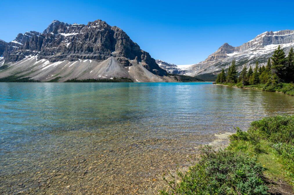
The first major stop along the Icefields Parkway that you won’t want to miss is the beautiful Bow Lake. Its crystal-clear turquoise waters are surrounded by towering peaks, creating a postcard-perfect setting. There’s not a whole lot to do here at this lake except, well, look at it. The pullout we stopped at (in the Google maps link above) was situated above the lake level, so you had to climb down a steep embankment to get to the lakeshore (where the photo above was taken).
2. Peyto Lake:
Attraction type: Short hike (uphill!) to viewpoint.
Time Needed: 45 minutes to an hour due to the hike.
Google Maps Location: https://goo.gl/maps/dLDwfxrcWtFuTAdF7
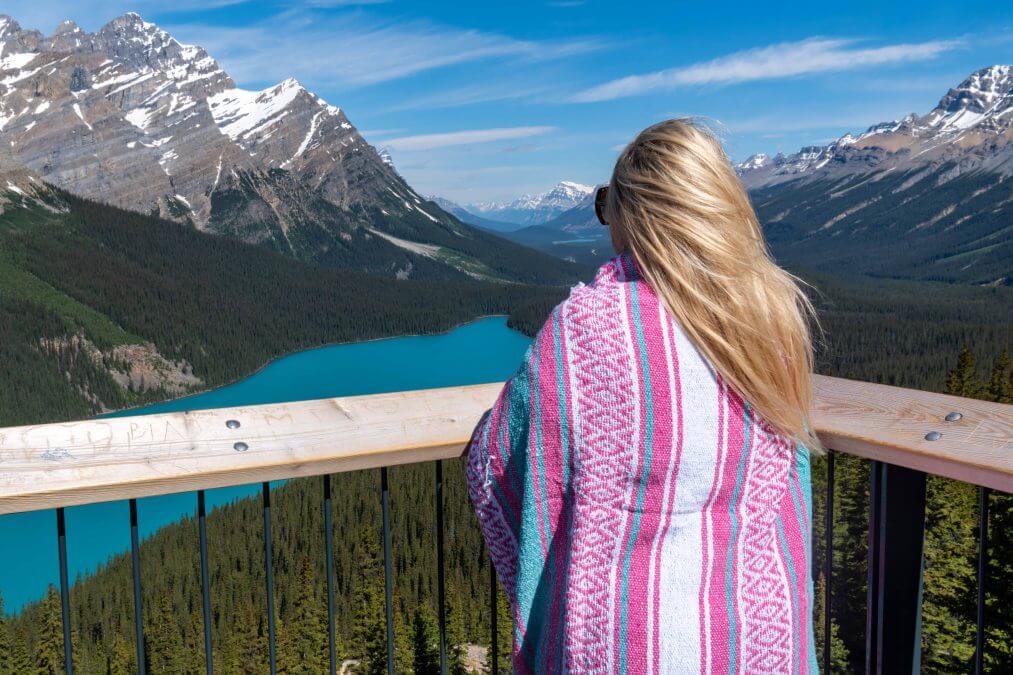
Want to know the secret to a mind-blowing Instagram photo? Peyto Lake has got you covered!
Because, yes, the water really is that color – it’s truly something you’ll have to see for yourself in-person.
3. Mistaya Canyon:
Attraction Type: Short hike
Time Needed: 30 minutes
Link on Google Maps: https://goo.gl/maps/zt6xixr2D8a3tN738
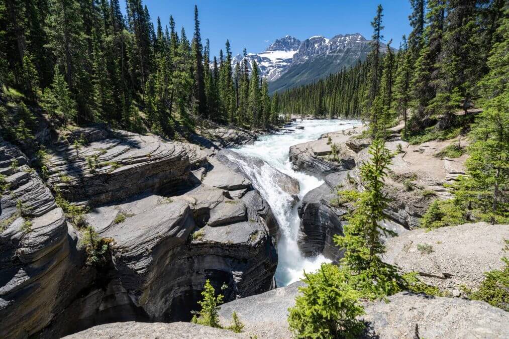
Located between Saskatchewan River Crossing and the Icefield Centre, Mistaya Canyon is a short walk (.3 miles one way) from the highway that leads you to a narrow gorge where the Mistaya River plunges through a series of dramatic water-carved rock formations.
The hike is short – total of 0.6 miles – but is downhill on the way to the canyon and uphill on the way back. It’s not as steep as the Peyto Lake hike – it only has about 130 feet of elevation gain on the way back.
4. Saskatchewan River Crossing

Type of Attraction: Store, Gas Station
Time Needed: 10-20 minutes. More if you’re eating in the restaurant
Google Maps location: https://goo.gl/maps/ZXuCLcH4JcAegozM6
At about the 1/3 point through your journey up the Icefields Parkway, you’ll come across the only gas station / convenience store along the route. So if you use the restroom, need to fill up / top off your tank, do so here. However, gas prices here are insanely expensive (they’ve always been this way, it’s not a new thing, it’s due to the remoteness of this area), but it’s cheaper than getting towed!
The Saskatchewan River Crossing store also features a restaurant and café, providing a place to refuel yourself with a meal or a quick snack. I personally wouldn’t eat here; the food looked very mid and the prices were very expensive.
There’s also quite a large gift shop here, but I’ve never purchased anything here. They have a lot of extremely tacky merchandise and it’s terribly overpriced – if you do find something here you want, you’re better off waiting until you get to Jasper or Banff and buy it at the gift shops there.
Additionally, there is a hotel here if you’d like to spend the night on the Icefields Parkway, but it’s quite difficult getting a room here during the busy summer season.
Interested in reading more about this gas station? Well, I wrote an entire post about it here.
5. Weeping Wall
Attraction Type: Roadside Pullout
Time Needed: 5 minutes
Google Maps Location: https://goo.gl/maps/N1jk2G5WHHYYczJY7
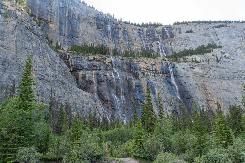
The Weeping Wall is another “blink and you’ll miss it” pullouts on the Icefields Parkway, so you’ll want to save this location to your Google Maps for reference while you’re on the road.
6. “The Big Bend” Overlook
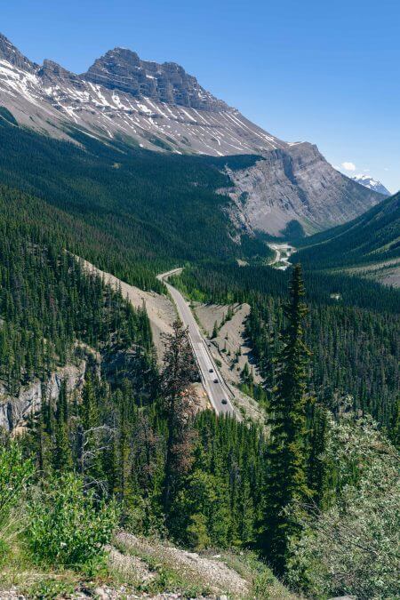
Attraction type: Roadside Pullout
Time Needed: 5 minutes
Google Maps Location: https://goo.gl/maps/G9KPkR8xbeXkG67L8
I absolutely love this overlook – it’s one of my favorite roadside pullouts / overlooks in the world! The stunning beauty of the Canadian Rockies with the road of the Icefields Parkway cutting through – knowing you were just down there a few minutes ago – AHH! Love it!
I’ve stopped here many times throughout the years and this overlook always gives me vertigo. Not quite sure why, as I don’t have an issue with vertigo anywhere else, but it happens to me every time I’m here, so I thought I’d mention it. My sister has this issue as well – so much so that she won’t get out of the car here anymore!
7. Parker Ridge Hike
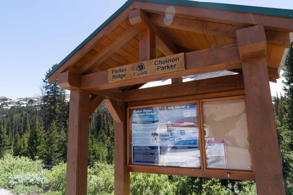
Attraction Type: Hike
Time Needed: 2-3 hours
Google Maps Location: https://goo.gl/maps/oKTA9tDCHcKGuyFa6
For panoramic views of the surrounding mountains and glaciers, a hike up Parker Ridge should be on your list. This moderate hike rewards you with breathtaking vistas of the Saskatchewan Glacier and the valley below.
The trailhead for the Parker Ridge Hike is right off the Icefields Parkway. The parking lot is fairly large, and even though this is a popular hike, you should be able to find a spot.
I haven’t personally done this hike yet but I’ve heard amazing things about it so if you have time, add Parker Ridge to your Icefields Parkway itinerary. It’s been on my list for years but the timing hasn’t worked out yet in my favor to do this hike.
8. Athabasca Glacier/Columbia Icefields
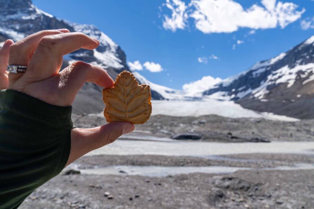
Attraction Type: Hike and/or guided tour
Time Needed: 1-4 hours
Google Maps Location:
For the Columbia Icefield Discovery Centre: https://goo.gl/maps/zc95Yc3wWr9YeCZMA
For the trailhead to the Athabasca Glacier “toe of the glacier” lookout: https://goo.gl/maps/NQgcrn2rpY1FLwKu8
The Columbia Icefield, one of the largest icefields in the Rocky Mountains, is an absolute must-see along the Parkway. Here, you can join a guided tour to walk on the glacier or hop on a specially designed vehicle known as the “Ice Explorer” to explore the glacier as well.
Or, if you have limited time (or limited funds – the glacier walks are pricey!), you can hike to the toe of the glacier for free. I’ve never done the glacier walk, and really don’t feel the need to – just hiking to the toe of the glacier is a great experience! The hike will take you about 30-45 minutes, maybe longer, depending on your fitness level. I suggest wearing closed toe shoes for this hike, as it is on an unpaved trail and some sections are very steep with loose rocks.
Note: You can still visit the Columbia Icefield Discovery Centre even if you’re not doing a tour. There’s a Starbucks inside, clean restrooms and a nice gift shop.
9. Tangle Creek Falls
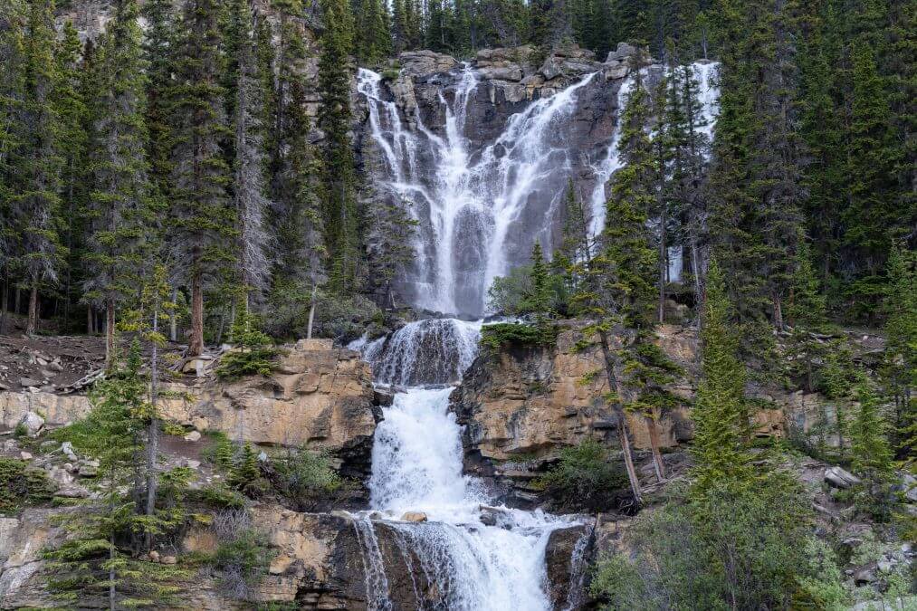
Attraction Type: Roadside pullout
Time Needed: 5 minutes
Google Maps location: https://goo.gl/maps/ULQQ4fvWuke21rik8
Tangle Creek Falls is really easy to miss – there’s a sign for Tangle Creek but not for the falls, so when driving by, you might think the sign is just to point out the creek, and that is not the case. I’ve driven the Icefields Parkway many times and only on my last trip here was I able to finally stop here! It’s best to save the location to your Google Maps so that you don’t pass it by when driving along.
10. Sunwapta Falls
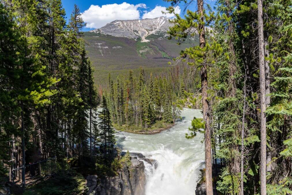
Attraction Type: Short hike
Time needed: 10-15 minutes
Google maps location: https://goo.gl/maps/UP2ANaVEmtTLvwJXA
Located in Jasper National Park, Sunwapta Falls is made up of two distinct sections: the upper falls, characterized by a broad curtain of water, and the lower falls, where the Sunwapta River dramatically narrows and plunges into a narrow gorge. This stop will only take a few minutes but is well worth it!
11. Athabasca Falls
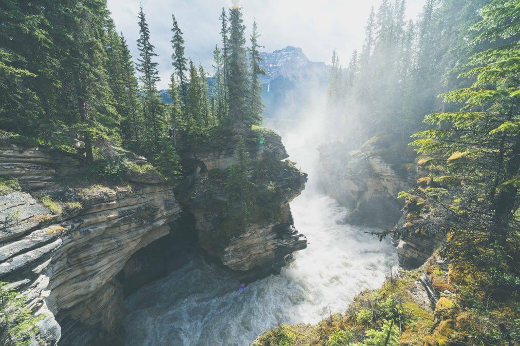
Attraction Type: Short hike
Time Needed: 20-30 minutes
Google Maps Location: https://goo.gl/maps/Rg57PbUu47Rcdd1f7
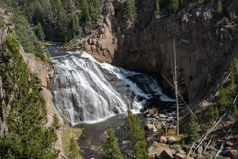
Located just minutes from the town of Jasper, Athabasca Falls is a powerful waterfall that showcases the sheer power of nature. Explore the various viewpoints and walking trails to witness the falls from different angles and capture stunning photographs.
Trails are all paved here, but there are a series of steps, depending on where you decide to go to see the falls.
There you have it! These are the main must-see spots along the Icefields Parkway – however, the scenery is absolutely stunning, so you’ll probably be pulling over and snapping more photos at other lookouts. The stops I’ve mentioned above are the main highlights of the area and with this itinerary, you should be able to see all of this in just one day. Have fun!
Have you driven the Icefields Parkway? What did you think? What are your favorite stops? Let me know in the comments!


One Comment